


Flood Checker Kanto Japan app for iPhone and iPad
Developer: Takafumi AMANO
First release : 24 Jan 2014
App size: 143.16 Mb
This app is a viewer of flood hazard maps in Kanto, Japan which includes Ibaraki, Tochigi, Gumma, Saitama, Chiba, Tokyo and Kanagawa prefecture. The app has all shelter information in Japan and floods in Kanto. Therefore, it can search the nearest shelter and flood level at a current location or an arbitrary one.
■ How to Use
Please do not use this app without a rehearsal in time of a disaster, because the app was created for a desktop exercise. And be sure to check neighboring shelter information by a newsletter in your city.
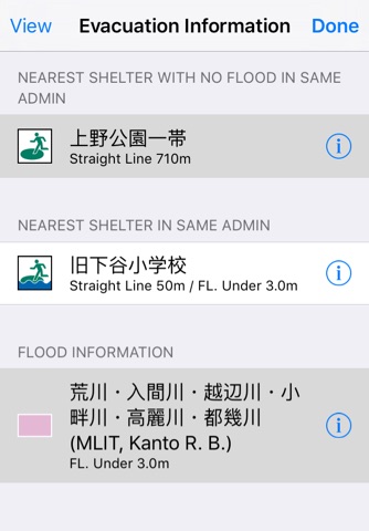
The app shows an address and a flood level at a central location on a screen map. If the location has some floods, the app searches for the maximum flood level in the floods. Tap a shelter icon, it shows a balloon with shelter name and types. If you tap the balloon then, the app shows detailed information about the shelter.
There is a toolbar under the screen. The toolbar has seven functions: Show current location, Change map type, Search shelters, Shelter layer switch, Floods layer switch, Move and App information.
1. Show current location
It moves the center of a screen map to a current location.
2. Change map type
It changes a map type in order of a map, a hybrid, and an aerial photograph.
3. Shelter layer switch
It turns on/off shelter icons. If the map scale is less than 1/250000, the icons are hidden automatically.
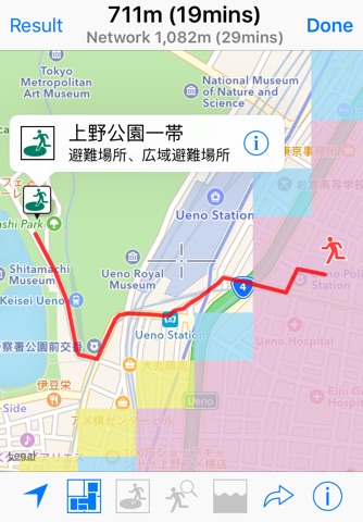
4. Search shelters
It searches the nearest shelter from a location that is the center of a screen map. And changes to detail check mode. You can check the nearest shelter and related floods in this mode. The finish is to tap the “Done” button.
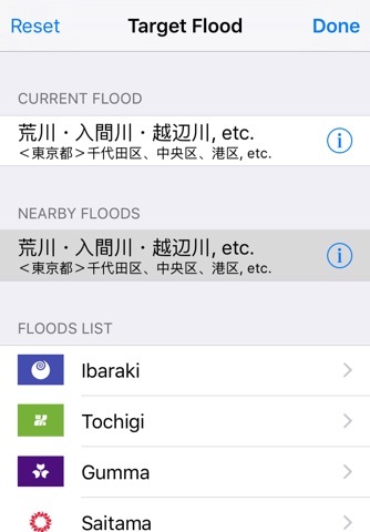
5. Set target flood
You can choose a displaying flood. If you set the flood, the app shows the flood level of only chosen flood.
6. Move
It shows a local government list in Japan. If you select the government, the center of the screen map moves to a location of the selected government office.
7. App Information
It is displayed a legend, notices, data sources and exemption from liability.
■ Data Sources
1. National Land Numerical Information, Flood Zones (2012, MLIT Japan)
2. National Land Numerical Information, Shelters (2012, MLIT Japan)
■ Notes
1. If you have found any English mistakes please let us know.
2. The app doesn’t provide updated information in the case of shelters being retrofitted or relocated.
3. The shortest route given may not always be accurate.
4. Flood zone data is accurate as of 2012.
5. Proper nouns are displayed in Japanese only.
■ Exemption from Liability
ASTI will not be held liable for anything that transpires as a result of using this information. No liability whatever will be accepted for any damage, injury or loss that may be suffered as a result of using the app.